AI Insight
A Government Accountability Office report warns that budget cuts to NOAA's GeoXO satellite program have introduced significant risks to weather monitoring capabilities. The program was reduced from six satellites with five instruments to four satellites with two instruments, cutting costs from $19.6 billion to $13 billion but eliminating critical tools including an upgraded lightning mapper, ocean color instrument, and atmospheric composition instrument. The report indicates the 2032 launch schedule may create gaps in satellite data continuity, potentially leaving the US with reduced observational capacity compared to current systems.
Why it matters
GeoXO satellites are essential for hurricane forecasting, severe weather warnings, air quality monitoring, and tracking environmental hazards like harmful algal blooms and oil spills. The elimination of the lightning mapper is particularly concerning as it would provide less capability than existing satellites, potentially degrading thunderstorm and tornado warning systems that protect lives and property.
Understand the Science
body {background-color: #D2D1D5;}
Research & Developments is a blog for brief updates that provide context for the flurry of news regarding law and policy changes that impact science and scientists today.
Last week, the Government Accountability Office (GAO) released a report suggesting that the plan for NOAA’s next generation of geostationary satellites, called GeoXO, could “put vital observations at risk.”
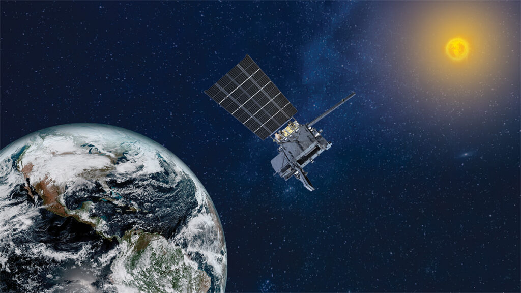
NOAA currently has four geostationary satellites in orbit—the Geostationary Operational Environmental Satellite-R (GOES-R) series—which monitor more than half the globe from 22,236 miles (35,785 kilometers) above Earth’s equator. Two are operational, and two serve as backups. These satellites provide a wealth of data that improve hurricane and storm forecasting, monitor smoke and dust, improve aviation route planning, provide advanced warning of lightning hazards, and monitor space weather, to name a few benefits.
GeoXO, short for Geostationary Extended Observations, is intended to replace the GOES-R series. NOAA’s initial plan was for GeoXO to include six satellites and five instruments, at a projected lifecycle cost of $19.6 billion. However, after being directed to cut costs by the Department of Commerce, NOAA’s new plan includes just four satellites, two instruments, and a lifecycle cost of $13 billion.
Some felt that the cuts were not made for purely financial reasons.
“OMB’s motives were hardly subtle: the goal was to deprive NOAA’s satellites of the capability to collect scientific data that would inform the American people about the reality of climate change in our world,” wrote Rep. Zoe Lofgren (D-CA) and Rep. Gabe Amo (D-RI) in a letter to NOAA Administrator Neil Jacobs earlier this week.
GAO’s Report
The GAO reviewed the GeoXO program in response to a request from members of Congress. The resulting report outlined several problems with the program’s diminished budget.
For instance, new version of the GeoXO program also eliminates three instruments originally planned for:
- an updated version of the existing lightning mapper, which could improve thunderstorm and tornado warnings and tropical storm diagnoses.
- an ocean color instrument, which could identify harmful algal blooms, monitor water quality, assess habitat and species protection efforts, and track oil spills.
- an atmospheric composition instrument, used for air quality monitoring and forecasting as well as monitoring emissions and airborne hazards.
Mike Henry, senior adviser to Knowledge for a Competitive America and former policy analyst at UCAR, NASA, and the American Institute of Physics, noted that geostationary satellite data are used in many ways people may not realize, such as by builders and insurers to calculate the risk of damaging storms and ultimately the price of homes. He also noted particular concern about the descoping of the lightning mapper, which would leave us with less capability than what is currently in orbit.
Though there exist ground-based methods for mapping lightning, “the space-based capabilities are the best because you have the largest swath of view from space, so you’re able to pick up much more and be much more comprehensive,” he told Eos. “So it is really concerning, and we want to be able to maintain those in the next-generation system.”
The GAO report also suggests that the scheduled first launch of a GeoXO satellite in 2032 creates “a risk of a gap in the continuity of satellite data.” NOAA’s policy, the report states, requires that at least two operational satellites and one spare be available. On this schedule (which was in place before the reduced budget was announced), the current spare satellite would stop being operational months before the first GeoXO satellite is fully up and running.
In addition, the report notes that the office has not yet completed an independent cost estimate for the new budget, making it “unclear whether the $13 billion estimate for the restructuring is reasonable.”
The GAO report, provided to the Department of Commerce, NOAA, and NASA last month and made public last week, recommends that the Secretary of Commerce ensure the NOAA administrator record the cost estimate for the new GeoXO program, update its contingency plans, and document a technology readiness assessment for each instrument.
It closes by noting that the program hasn’t yet incorporated lessons learned from prior satellite programs, particularly as it relates to contingency planning and assessing technical readiness.
“Without incorporating these lessons learned, the program may not meet cost, schedule, or performance goals, which could put vital weather observations at risk,” it reads.
—Emily Gardner (@emfurd.bsky.social), Deputy Editor
These updates are made possible through information from the scientific community. Do you have a story about how changes in law or policy are affecting scientists or research? Send us a tip at eos@agu.org.

Text © 2026. AGU. CC BY-NC-ND 3.0
Except where otherwise noted, images are subject to copyright. Any reuse without express permission from the copyright owner is prohibited.
Source: Cuts to Satellite Program Add “Uncertainty” and “Risk,” Suggests GAO Report