AI Insight
NASA satellite imagery from November 28, 2025, captures the dramatic tidal transformations occurring twice daily in Guinea-Bissau's Bijagós Archipelago, a region consisting of 88 islands and islets. The tidal cycles cause intertidal mudflats and sandflats to emerge during low tide, temporarily and significantly expanding the apparent size of islands before they shrink again as tides rise. These tidal flows move through a complex network of sandy channels, mudflats, and mangrove forests that characterize the archipelago's coastal ecosystem.
Why it matters
This observation highlights the dynamic nature of intertidal zones in archipelago systems, which are critical habitats for wildlife and demonstrate the importance of satellite monitoring for understanding coastal landscape changes. These regions support diverse ecosystems including mangrove forests that provide coastal protection and serve as important nurseries for marine species.
Understand the Science
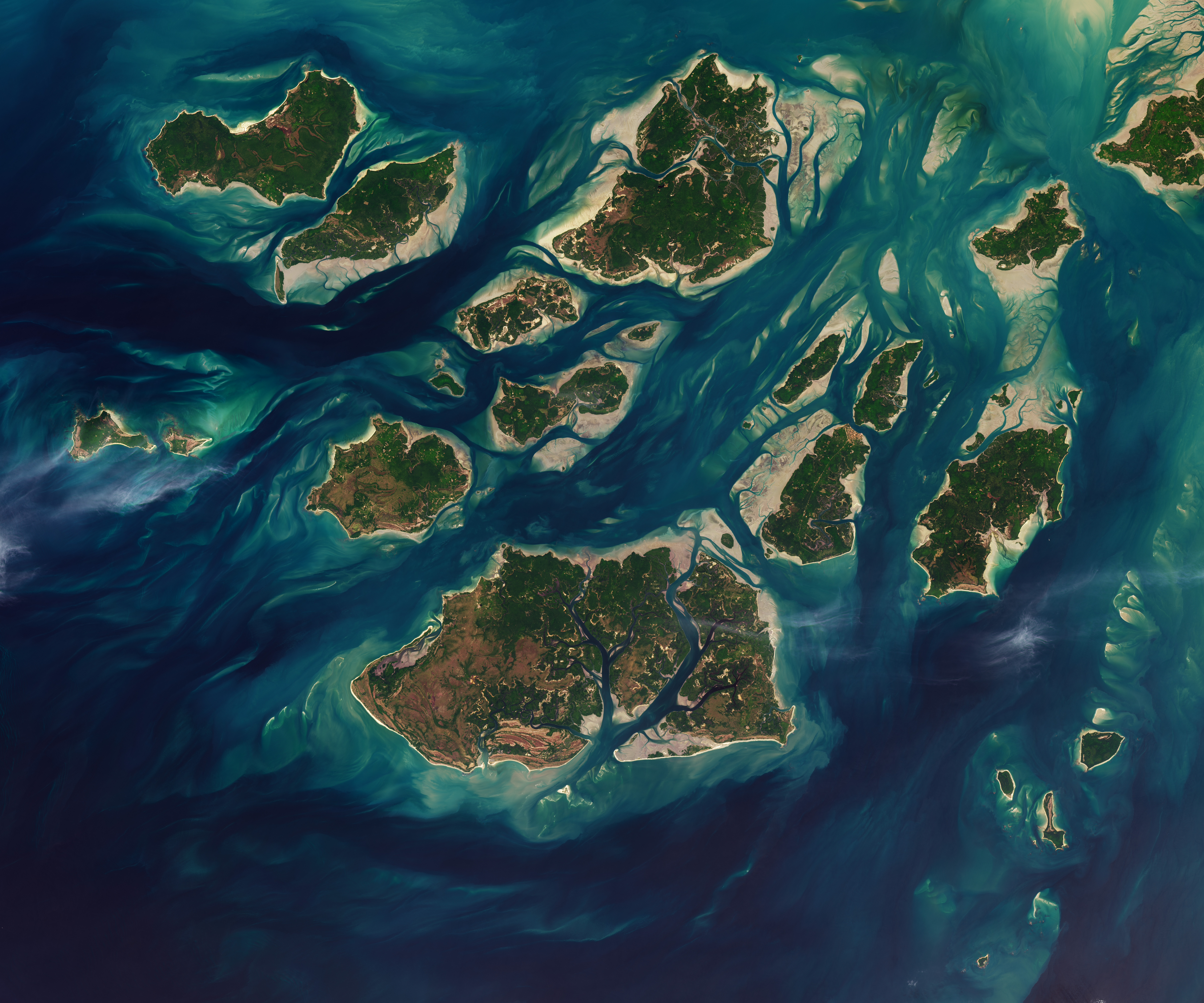
Twice each day, tides ebb and flow through a maze of sandy channels, mudflats, and mangrove forests that flank the 88 islands and islets of Guinea-Bissau’s Bijagós Archipelago (Arquipélago dos Bijagós in Portuguese). Seen from above in this image from Nov. 28, 2025, the process leads to stark changes to the landscape: around low tide, intertidal mudflats and sandflats emerge from the sea, causing islands to grow significantly before shrinking again hours later.
Learn more about the region and its wildlife.
Text credit: Adam Voiland
Image credit: NASA/Lauren Dauphin, USGS
Source: Guinea-Bissau Tidal Waters