AI Insight
High resolution Pléiades satellite imagery has been acquired of the Langtang Lirung landslide source area in Nepal that occurred on August 26, 2026. The imagery reveals a large-scale wedge-shaped failure with planar surfaces indicating the landslide mobilized along pre-existing geological weaknesses such as major joint or fault planes. The steep terrain, including a near-vertical lower slope section, allowed significant kinetic energy accumulation during the landslide event.
Why it matters
Understanding the geological structure and failure mechanisms of this major landslide disaster will help improve hazard assessment and early warning systems in mountainous regions with similar geological conditions. The detailed satellite imagery enables precise analysis of the failure geometry and can inform future slope stability evaluations in Nepal and comparable terrain.
Understand the Science
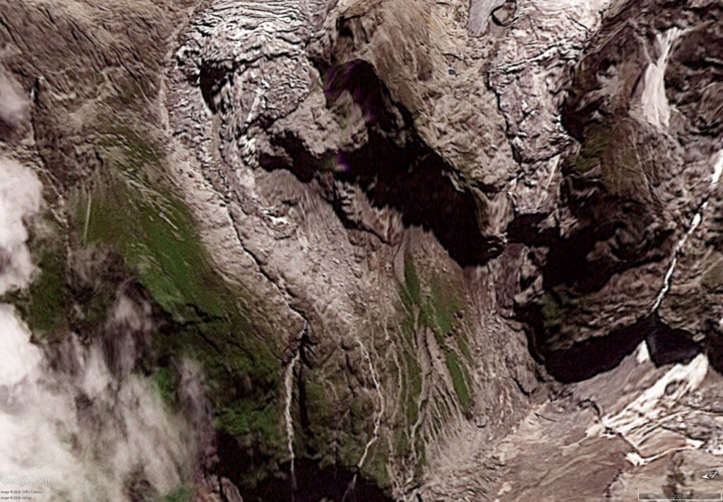
Simon Gascoin has posted some high resolution satellite imagery of the source of the dreadful landslide disaster in Nepal.

On the CESBIO Multitemp blog, Simon Gascoin has posted high resolution CNES Pléiades satellite imagery of the source area of the 26 August 2026 Langtang Lirung landslide in Nepal. This is the first high resolution imagery that I’ve seen.
The imagery was collected as part of work to understand this landslide, with the acquisition having been arranged by Kristen Cook and Étienne Berthier under the CIEST2 programme.
Pléiades satellite imagery is made available under copyright, so I won’t reproduice it here – but it was worth visiting the CESBIO Multitemp blog to view it. However, Simon has produced a short animation of the imagery:-
This animation brings the landslide to life. There are a few things to note. The first is the scale and steepness, which are both hard to appreciate from other imagery. Second, as I suspected, the failure has a wedge form, with the source area having very planar surface, suggesting that it mobilised existing planes of weakness (a major joint or fault plane).
Note also the planar nature of the middle slope too – this is also a pre-existing joint or fault. This surface extends beyond the landslide area.
The lowest portion of the slope, to the valley floor, is near vertical, which would have allowed a huge increase in kinetic energy.
The imagery will allow Simon, Kristen, Étienne and others to analyse the landslide in detail. Slowly, the true picture is emerging.
Text © 2026. The authors. CC BY-NC-ND 3.0
Except where otherwise noted, images are subject to copyright. Any reuse without express permission from the copyright owner is prohibited.
Source: High resolution Pléiades Satellite imagery of the 26 August 2026 Langtang Lirung landslide in Nepal