AI Insight
Stewart Island/Rakiura, New Zealand's third-largest and southernmost inhabited island, was captured in a rare cloud-free satellite image by Landsat 9 on May 14, 2026. The island, located 30 kilometers south of New Zealand's South Island, features Rakiura National Park covering 85 percent of its area, with podocarp and hardwood forests, shrublands, wetlands, and coastal dunes supporting diverse wildlife including the Stewart Island tokoeka kiwi and the rare kākāpō parrot. The island was designated an International Dark Sky Sanctuary in 2019 and is undergoing a large-scale conservation project to eradicate invasive predators including rats, possums, feral cats, and hedgehogs.
Why it matters
The successful predator eradication on nearby Ulva Island in 1997 has created a model for the larger-scale conservation effort now underway on Stewart Island/Rakiura, which could significantly protect native flightless bird populations including threatened species. The island's protected status as both a national park and dark sky sanctuary demonstrates the integration of ecological and astronomical conservation efforts in remote areas.
Understand the Science

Stewart Island/Rakiura is the third-largest island in New Zealand, diminutive in comparison to the country’s North Island and South Island. Yet it hosts a population of one of the largest of the kiwi: the Stewart Island tokoeka. This flightless bird, a subspecies of the Southern brown kiwi (Apteryx australis), numbers in the thousands on the island, dwarfing its human population of approximately 500.
The avian national icon is just one slice of the natural riches on Stewart Island/Rakiura, a roughly triangular piece of land about 30 kilometers (19 miles) south of the South Island. Rakiura National Park covers about 85 percent of the bright green island. And as the Māori name—Rakiura, meaning “glowing skies”—suggests, it’s a prime location for viewing the aurora australis.
On the northern half of the island, podocarp and hardwood forests featuring coniferous trees with ancient lineages blanket the land. Other areas are covered in shrublands and wetlands, as well as coastal dunes such as those lining Mason Bay. A diversity of birdlife, including the kiwi, populates these relatively untouched ecosystems. The tall trees of the podocarp forests produce various fruits attractive to avian inhabitants, such as bellbirds, with their pure-toned calls, and the rare kākāpō, the world’s heaviest and only flightless parrot species.

One notable haven for birds lies on Ulva Island, located within the inlet near Halfmoon Bay (Oban). Rats, which once preyed on bird eggs and chicks there, were deemed eradicated in 1997, and the island has mostly remained free of non-native predators. Conservationists have since embarked on a project on the much larger Stewart Island/Rakiura to eliminate rats, possums, feral cats, and hedgehogs.
When darkness falls, Stewart Island/Rakiura’s human denizens can look skyward for the chance to observe stars, auroras, nearby dwarf galaxies, and other features of the Southern Hemisphere night sky. In 2019, the remote and sparsely inhabited island was designated an International Dark Sky Sanctuary.
Amateur astronomers there and in other places with good night-sky views might search for objects of interest through Hubble’s Night Sky Challenge. In May, when this image was acquired, targets imaged by NASA’s Hubble Space Telescope that were also visible from Earth’s southern latitudes included a star cluster called the Jewel Box and a peculiar elliptical galaxy known as Centaurus A, which may have resulted from two galaxies colliding.
NASA Earth Observatory image by Michala Garrison, using Landsat data from the U.S. Geological Survey. Photo and story by Lindsey Doermann.

References & Resources
- DarkSky International (2019, January 3) Stewart Island / Rakiura. Accessed July 29, 2026.
- The Guardian (2022, July 6) New Zealand to embark on world’s largest feral predator eradication. Accessed July 29, 2026.
- New Zealand Department of Conservation, Birds. Accessed July 29, 2026.
- New Zealand Department of Conservation, Podocarp-hardwood forests. Accessed July 29, 2026.
- New Zealand Department of Conservation, Stewart Island/Rakiura. Accessed July 29, 2026.
You may also be interested in:
Stay up-to-date with the latest content from NASA as we explore the universe and discover more about our home planet.
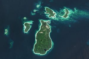
Beaver Island is one in a string of verdant and scenic jewels in a northern Lake Michigan archipelago.
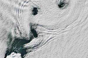
Icy, isolated Peter I Island stirred up a show in the atmosphere off the West Antarctic coast.

Marshy, sandy terrain and an impassable inlet helped colonial forces repel British forces during a pivotal battle on the barrier…



