AI Insight
Scientists are using satellite imagery from Landsat 8 to track Adélie penguin populations and dietary patterns on Antarctica's Danger Islands by analyzing the color of their guano. The pink-orange coloration visible from space indicates a krill-rich diet, as krill are bright pink due to the algae they consume. Researchers combine satellite data with drone imagery and guano samples to monitor how penguin diets change in response to shifting sea ice conditions.
Why it matters
This remote sensing technique allows researchers to monitor penguin populations and Antarctic ecosystem health without constant physical presence in one of Earth's most inaccessible regions. The data helps scientists understand how climate-driven changes in sea ice are affecting the Antarctic food web structure.
Understand the Science
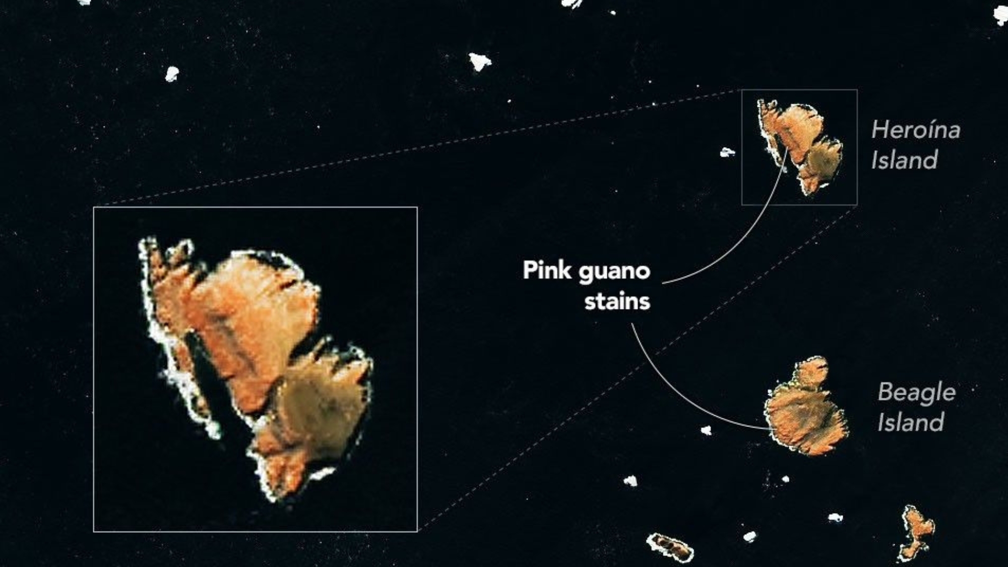
The diets of penguins on Antarctica’s Danger Islands can be seen from space. At least indirectly.
Using satellite images captured by the Landsat 8 spacecraft operated by NASA and the United States Geological Survey, scientists can track changes in Adélie penguins’ diets based on the color of their guano, or droppings.
What is it?
The image above shows pinkish-orange guano staining large sections of some of the Danger Islands, Heroína Island and Beagle Island. The penguins that live there eat a diet rich in krill, small marine crustaceans that are bright pink in color due to a specific type of algae upon which they feed.
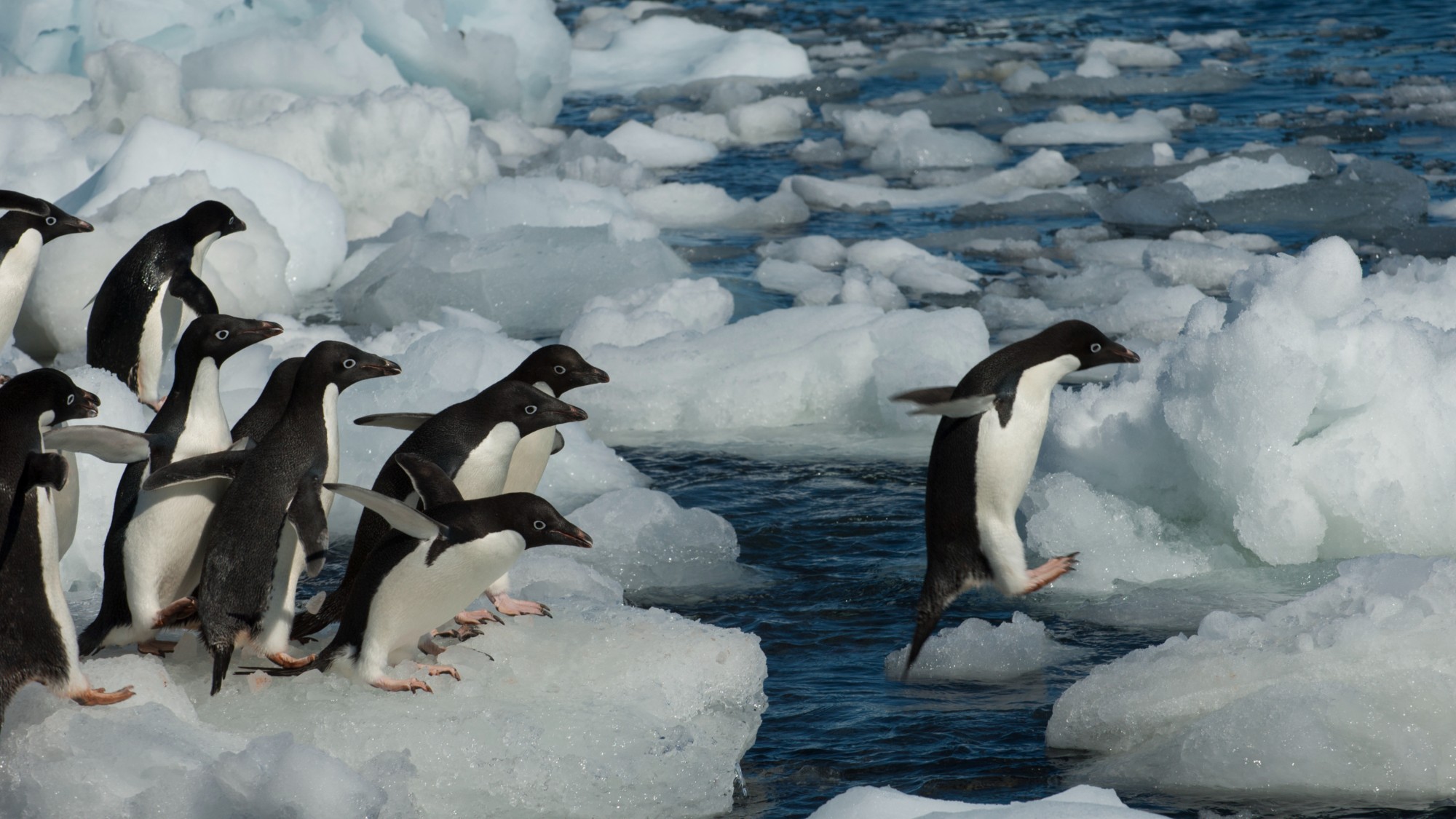
The bright pink color of the penguins’ droppings stands out in satellite imagery, allowing researchers to monitor the birds’ populations from space. But scientists wanted a closer look, and collected drone imagery as well, as seen in the image below.
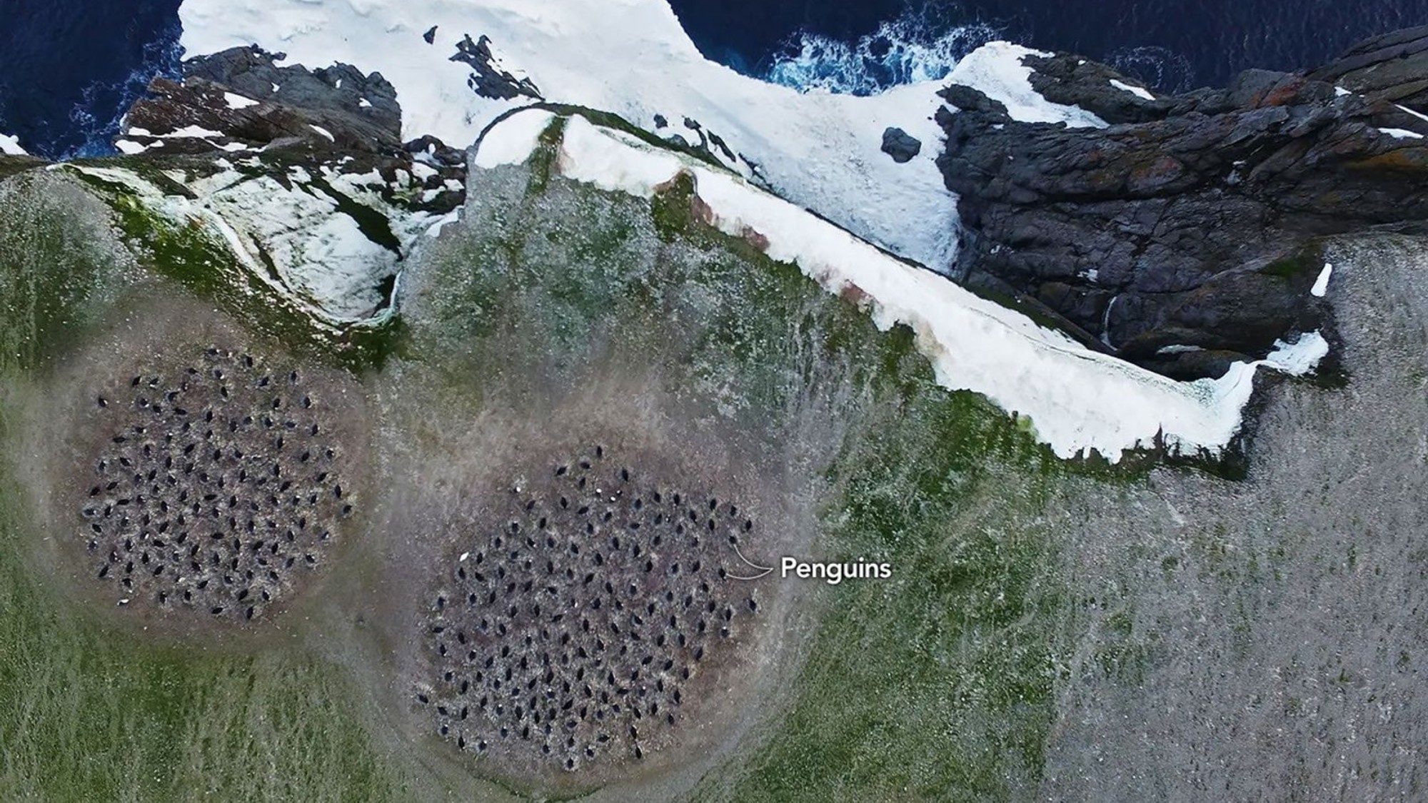
Why is it incredible?
It’s pretty amazing that the diet of a specific population of birds can be monitored from 438 miles (705 kilometers) above Earth’s surface. The imagery collected by Landsat-8 helped scientists locate where the penguin colonies might be, allowing them to find them in-person and collect guano samples. Those samples contained evidence of what the penguins were eating over time.
Researchers are using those satellite images and samples to track how the penguins’ diet might be affected by changes in sea ice conditions, according to a NASA statement.
“Sea ice is such a hugely important factor in the Antarctic marine environment,” said Clemson University biologist Casey Youngflesh who led a study comparing the penguins’ diet and sea ice conditions. “The structure of the region’s food web is changing in response.”
Source: Satellites spy penguin poop on Danger Islands | Space photo of the day for July 30, 2026