AI Insight
On 4 July 2026, a massive landslide in Zamora Chinchipe province, Ecuador killed 19 people and destroyed approximately 50 houses in the community of Cantzama. Satellite imagery analysis revealed that a 1-kilometer-long landslide occurred 13 kilometers upstream, which transformed into a channelized debris flow that traveled the extraordinary distance to reach the village. Previous satellite images from December 2025 show that the same slope had experienced shallow failures between June and August 2025, suggesting that earlier rainfall events may have destabilized the hillside and predisposed it to catastrophic failure during subsequent heavy rains.
Why it matters
This event demonstrates how prior rainfall-induced slope damage can create conditions for later catastrophic failures, highlighting the importance of monitoring slopes that show early signs of instability. The extremely long runout distance of 13.5 kilometers also underscores the hazard potential of debris flows in mountainous regions, informing land-use planning and community relocation decisions in vulnerable areas.
Understand the Science
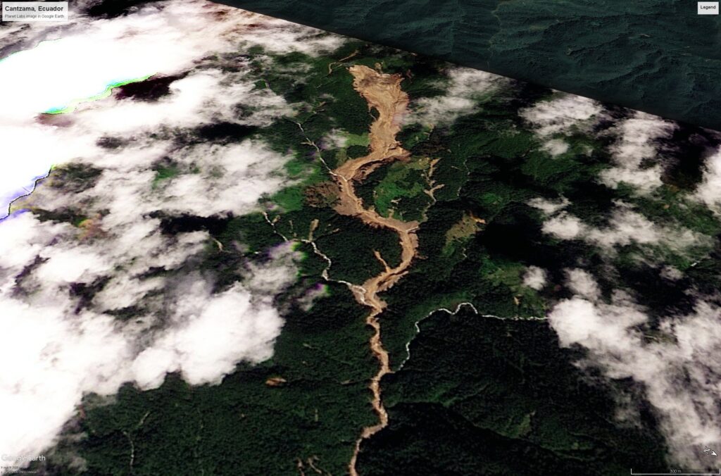
On 4 July 2026, 19 people were killed in a massive landslide in Zamora Chinchipe province, Ecuador. Planet Labs imagery shows that this was caused by a c.1 km long landslide that occurred 13 km upstream of Cantzama. This transitioned into a channelised debris flow that destroyed the community.

On 4 July 2026, a massive landslide swept through Cantzama in Zamora Chinchipe province, Ecuador. News reports indicate that 19 people were killed and around 50 houses were destroyed or damaged. As is often the case with disasters of this type in places like Ecuador, this event garnered little press coverage in the west, but it is quite significant event.
There is some Youtube drone footage of the aftermath of the disaster:-
Fundacion Pachamama has quite a detailed analysis of the event, compile using radar imagery, which describes a large, long run out debris flow / mudflow event. They were unable to pinpoint a cause of the flow, but I think Planet Labs optical imagery allows us to diagnose what happened.
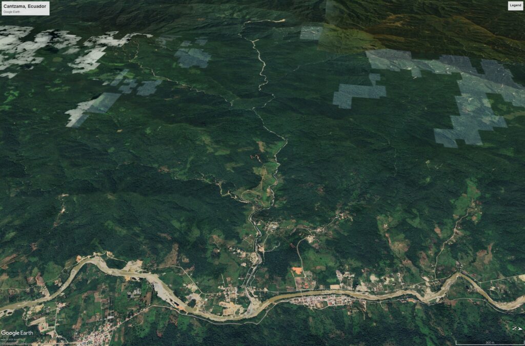
The location of the most seriously damaged parts of Cantzama is 3.85480° S, 78.89506° W [-3.85480, -78.89506]. This is a Google Earth view of that site, with the village in the foreground and the tributary valley down which the landslide flowed in the background:-
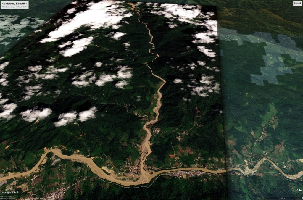
This is a Planet Labs image, dated 5 July 2026, showing the aftermath of the landslide. The path of the flow is very clear, as is the damage to a range of buildings around the channel:-
If we go upstream from Cantzama we reach this point:-
The location of the crown of this major landslide is 3.88474° S, 79.00312° W [-3.88474, -79.00312]. The initial failure of the landslide is about 1 km long and 300 m wide. This major failure has transitioned into a channelised debris flow – the linear distance to the Cantzama is about 13.5 km – this is an extremely long runout event. It appears that the landslide has entrained a significant amount of sediment from the channel, leading to an extremely damaging flow.
As such this is an unusual landslide. There is another interesting and intriguing aspect. The image below, collected on 04 December 2025, shows the area around the main failure of the landslide. The marker shows the location of the crown of the 4 July 2026 landslide:-
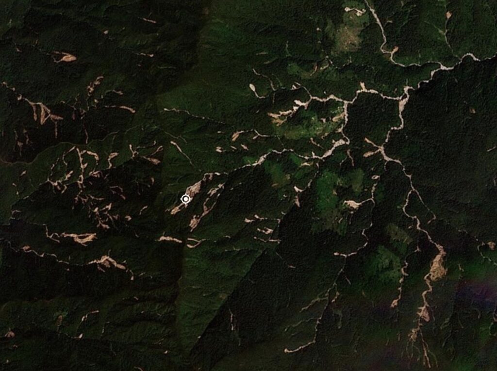
There is a host of shallow failures across the hillslopes, which appear to have been triggered between 22 June 2025 and 08 August 2025. Presumably this was a response to a heavy rainfall event. Note that the site of the 4 July 2026 landslide had suffered a substantial failure in this earlier rainfall event.
Is it possible that this 2025 rainfall event destabilised the slope, creating a situation in which it then destabilised in the next major rainstorm? It would be interesting to look at the InSAR data for this slope.
As for Cantzama, there is a proposal to relocate the population located close to the channels, redesignating the site for tourism. That is probably wise.
Acknowledgement
Many thanks to Planet Labs for making the imagery available to me.
Text © 2026. The authors. CC BY-NC-ND 3.0
Except where otherwise noted, images are subject to copyright. Any reuse without express permission from the copyright owner is prohibited.
Source: The 4 July 2026 landslide disaster at Cantzama in Ecuador