AI Insight
Peatland fires burning across Indonesia in September 2026 are producing exceptional levels of pollution, with these fires generating three times more fine particulate matter than typical tropical forest fires, along with elevated levels of sulfur dioxide, organic carbon, methane, and carbon monoxide. NASA's MODIS satellite detected numerous fires across Borneo during an intensifying El Niño event, with fire activity tracking sharply upward similar to the severe 2015 fire season. As of early September 2026, the fires had released approximately 10 percent of the greenhouse gas emissions produced during the catastrophic 2015 season, when fires burned for over three months and released 1.75 billion tons of greenhouse gas equivalents.
Why it matters
These peatland fires pose severe health risks to millions of people through prolonged smoke exposure and contribute significantly to global greenhouse gas emissions. The fires are particularly difficult to control because they smolder underground through peat deposits, and their intensity is being exacerbated by drought conditions linked to El Niño and the Indian Ocean Dipole climate patterns.
Understand the Science
No Fire Detections
Fire Detections
If there were an apex predator among fires, tropical peatland fires would be a top contender. These fires, which burn in dried wetland soils, are slow-burning, highly polluting, and notoriously difficult to extinguish because they smolder at low temperatures and often burn underground through expansive deposits of peat. By one estimate, peat fires generate three times more fine particulate matter than other tropical forest fires, five times more sulfur dioxide, three times more organic carbon, and two times more methane and carbon monoxide.
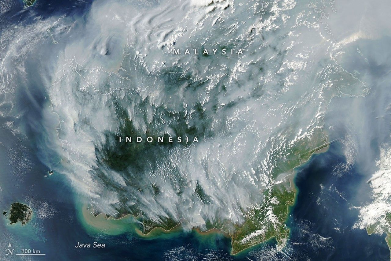
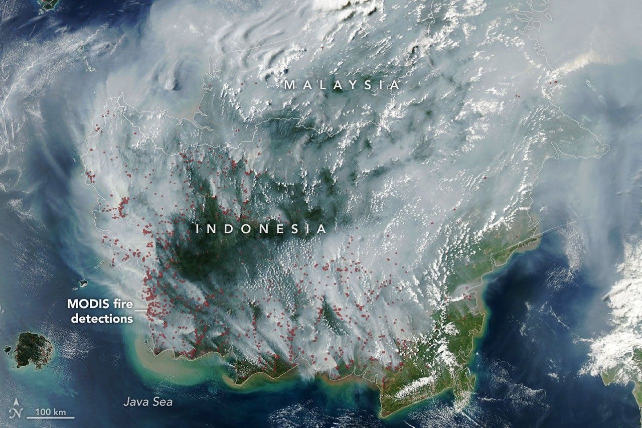
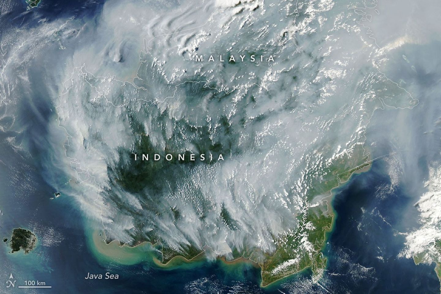
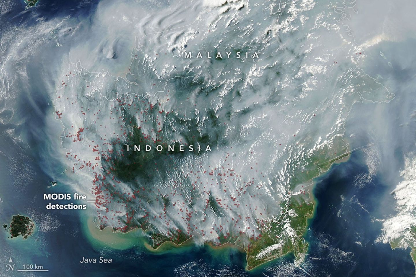
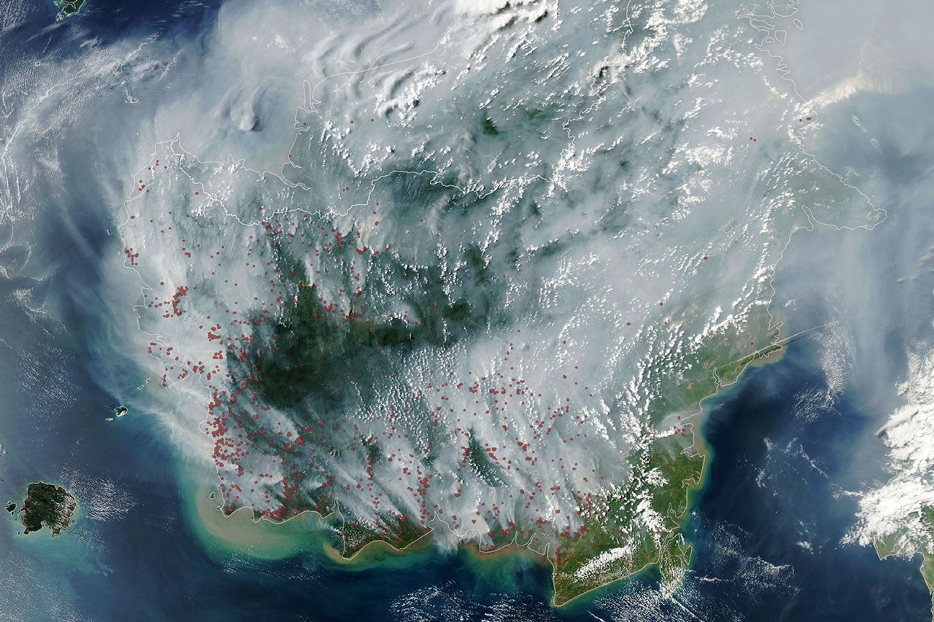
Fire season was underway in Indonesia when the MODIS (Moderate Resolution Imaging Spectroradiometer) on NASA’s Aqua satellite captured this image on September 1, 2026. In the map on the right, each red dot depicts one “fire detection.” A fire detection is a pixel in which the sensor and an algorithm determined there were thermal anomalies indicative of fire. Multiple detections can be generated by a single fire.
Peat fires are a recurring challenge in Indonesia, which is home to about 36 percent of the world’s tropical peatlands. When parched by drought, the archipelago’s peat landscapes have become unrelenting infernos on several occasions over the past three decades, with fires producing blankets of smoke for weeks on end and upending daily life for millions of people.
While fires occur in Indonesia every year, previous El Niño years—1997 and 2015 especially—produced the most extreme burning in recent decades. The climate pattern, assessed by NOAA as present and strengthening in August, typically leads to sharp reductions in rainfall in Indonesia, particularly when combined with a positive phase of the Indian Ocean Dipole, which was also present.
“Indonesia is only about three weeks into its fire season, but we’re seeing fire activity track sharply upward, similar to 2015,” said Robert Field, a Columbia University researcher who developed a tool called the Global Fire Weather Database that produces experimental, real-time fire weather forecasts. “The strong El Niño is making the dry season drier over the fire-prone parts of the country and exacerbating burning—just as we anticipated it would,” he said. In 2015, after burning for more than three months, Indonesia’s fires had released 1.75 billion tons of greenhouse gas equivalents—more than Japan emits in a year. As of September 2, Indonesia’s 2026 fires, having burned for about a month, have released roughly 10 percent as much as the 2015 fires.
As in 2015, Indonesia was in the midst of a severe and widespread drought in summer 2026. About 90 percent of the country received little to no rainfall in early August, according to data from the Indonesian meteorological agency. Normally, it’s too wet for fires to spread through underground peat deposits in Kalimantan, Sumatra, and Papua, but they can in dry conditions. “Surface fires are less of a concern, but when fires get underground, they just won’t stop,” Field said. “They’ll keep burning until the rains come in October or November.”
The Indonesian government uses NASA and NOAA observations from the MODIS and VIIRS sensors to track active fires in near-real-time. Indonesia’s Ministry of Forestry MODIS- and VIIRS-based fire-monitoring platform SiPongi, for instance, tallied 946 hotspots on August 31, 2026.
However, it’s difficult for MODIS and VIIRS to detect fires through thick smoke or clouds, within the forest understory, or underground in peat deposits. When Indonesian fires become the most intense, the number of fires recorded by VIIRS or MODIS can actually decrease. “The worst smoke events, paradoxically, can be the hardest to observe from space with MODIS and VIIRS,” said Mark Cochrane, an ecologist at the University of Maryland Center for Environmental Science who has conducted field research on peat fires in Indonesia for nearly a decade.
The large-scale construction of irrigation canals and drainage of peat swamps in the 1990s, part of an effort to establish massive rice farms, contributed to the flammability of the region today by significantly lowering the water table in wetland areas, Cochrane said. He also noted that oil palm and other plantation forestry is common in this region. Yet after an unusually grim fire season in 2015, governments and other organizations have worked to dam up some irrigation canals and restore wetlands. There have also been renewed efforts to improve firefighting capacity and reduce the number of fires that people accidentally ignite.
“This year will be a real stress test of the measures that were put in place after 2015,” said Shi Jun Wee, a University of Maryland graduate student. Wee is working on a team partnering with NASA and MapBiomas to develop new algorithms and techniques to detect more understory fires than MODIS and VIIRS can by tapping into shortwave infrared observations from Landsat and Sentinel-2 satellites. As the fires progress, he plans to track developments using NASA’s Worldview data browser, FIRMS (Fire Information for Resource Management System), HLS (Harmonized Landsat and Sentinel-2) observations, and GFED (Global Fire Emissions Database).
On the ground in Indonesia and neighboring countries, the smoke is already causing widespread disruptions. Indonesian officials have warned that large swaths of the population have been exposed to hazardous smoke. Some schools started shifting to remote learning, nine national parks have closed, and several flights have been delayed due to heavy smoke, according to news reports.
“People tend to focus on these fires during an El Niño and then forget about them,” Cochrane said. “We need sustained focus, even during the years when they aren’t as bad, to solve this,” he said. “These fires create a tremendous amount of emissions.”
NASA Earth Observatory image by Lauren Dauphin, using MODIS data from NASA EOSDIS LANCE and GIBS/Worldview. Story by Adam Voiland.
References & Resources
- BMKG (2026, August 13) Analisis Dinamika Atmosfer Dasarian I Agustus 2026. Accessed September 2, 2026.
- Channel News Asia (2026, September 2) Indonesia closes 9 national parks temporarily following forest fires; prioritises firefighting in 6 provinces. Accessed September 2, 2026.
- The Conversation (2026, August 23) Borneo forest fires spike again: Why El Niño isn’t the sole culprit. Accessed September 2, 2026.
- Field, R., et al. (2016, August 1) Indonesian fire activity and smoke pollution in 2015 show persistent nonlinear sensitivity to El Niño-induced drought. PNAS, 113 (33) 9204-92.
- Kementerian Kehutanan Republik Indonesia (2026, August 31) Update Terbaru Karhutla: Hotspot Menurun, Penanganan Diperkuat. Accessed September 2, 2026.
- NASA Earth Observatory (2015, December 1) Seeing Through the Smoky Pall: Observations from a Grim Indonesian Fire Season. Accessed September 2, 2026.
- ReliefWeb (2026, August 25) IDN: Fire – 07-2026 – Indonesia: Forest Fires and Haze in Sumatra and Kalimantan. Accessed September 2, 2026. Accessed September 2, 2026.
- Van der Werf, G., et al. (2025) Landscape fire emissions from the 5th version of the Global Fire Emissions Database (GFED5). Scientific Data, 12, 1870.
- Yokelson, R., et al. (2022) Tropical peat fire emissions: 2019 field measurements in Sumatra and Borneo and synthesis with previous studies. ACP, 22, 10173-10194.
You may also be interested in:
Stay up-to-date with the latest content from NASA as we explore the universe and discover more about our home planet.

In fire-prone ecosystems in Australia’s Northern Territory, prescribed burns are lit to minimize the severity of fires later in the…

Wildland fires in early August 2026 pushed air quality to unhealthy levels, destroyed hundreds of structures, and triggered mandatory evacuations…

The blaze burned more than 150 square miles and swept through parts of a ski resort.



